Cadastral linework
A cadastral line on a computer screen can look wonderfully certain. It is thin, continuous and usually drawn with more geometric neatness than the paper map that preceded it. By the late 1980s New Zealand was building a national database full of such lines, converting cadastral record maps into digital parcel geometry district by district. The appearance was modern. The evidence underneath it was often much older.
That distinction sits at the centre of New Zealand’s digital cadastre. The cadastre encompasses far more than a map of property boundaries. It is the wider system of survey records, parcel descriptions, marks, measurements and legal processes used to locate land interests and maintain the relationship between land and title. A cadastral survey plan records survey evidence about boundaries. A record map brings parcels together for administrative use. A digital parcel polygon is another representation again. It can be extremely useful without being the legal boundary itself.
Chapter 3 followed MAPPAK, the Department of Lands and Survey’s late-1970s computer-assisted cadastral mapping work. That system showed that cadastral linework could be captured as coordinates, edited and plotted again rather than redrawn from scratch. It also exposed a basic problem that survived better computers: the quality of digital geometry remained tied to the material from which it was derived. MAPPAK and DCDB addressed related cadastral problems. DCDB was a separate programme operating on a much larger scale.
Records made for different jobs
Before a national digital database, cadastral information already existed in several forms because it had several jobs to do. Survey plans recorded measurements, marks, bearings, distances and the surveyor’s definition of parcel geometry. Cadastral record maps compiled parcels across an area so staff could find and administer them. Title records dealt with ownership and registered interests. Registers, indexes and plan references connected one set of records to another. None of those objects on its own was the cadastre, and their different purposes became important when officials tried to convert them into one electronic environment.
The record map was especially useful for finding where a parcel sat in relation to its neighbours. It was not necessarily constructed to preserve survey-grade coordinates for every boundary corner. In dense areas it could be compiled at a large scale and show considerable detail; in remote areas a much smaller-scale sheet might be sufficient for administration. The map was an index and working record created under the constraints of its time. DCDB inherited that role first, which explains both why it became so useful to GIS users and why later survey conversion had to return to the underlying plans and measurements.
The transition therefore involved more than changing media. Paper records distributed meaning across separate objects and office practices. Staff knew which plan to retrieve, which register to consult and when a line on the record map was only approximate. A database had to make more of those relationships explicit. Identifiers, references and topology had to carry part of the institutional knowledge that previously sat in filing systems and in the heads of experienced survey and cadastral staff.
A national conversion job
Sources · 1
1. DCDB conversion chronology. Use LINZ cadastral-reform and historical DCDB documentation for the 1985–1996 conversion span. Retain the 1991 United Nations New Zealand country report as the period source for conversion progress and the December 1990 snapshot of about 1.066 million parcel polygons, approximately 42 per cent of the estimated national total. The difference between 1985 programme preparation and 1986 descriptions of formal conversion commencement is already controlled in the Chapter 13 editorial note and should not be collapsed into an artificial single start date.
Official LINZ retrospective material dates the national conversion of cadastral maps and record sheets into the Digital Cadastral Database from 1985 to 1996. Other period descriptions place formal programme commencement in 1986. The difference is less dramatic than it first appears. Early conversion and programme preparation were under way by the middle of the decade, while the national production programme became more formally visible soon afterwards. The next stage required structured survey and parcel data. It was a long exercise in turning interpreted map content into structured data.
A record map had to be registered to a digitising table so that the system knew how positions on paper related to coordinates. Operators then traced selected parcel lines and other relevant features with an electronic cursor. Numeric information could also be entered from the keyboard. The captured geometry had to be checked, corrected and connected properly. New cadastral activity did not stop while the old records were being converted, so the production teams had two jobs at once: build the national database and keep the changing cadastre current.
The scale of the work is visible in a 1991 United Nations country report on New Zealand cartography. By December 1990 the DCDB contained about 1.066 million parcel polygons, roughly 42 per cent of an estimated 2.5 million. The figure describes the volume of work. Every one of those polygons came from a process of source preparation, capture, interpretation, checking and database maintenance. National coverage was being assembled one district and one collection of records at a time.
The people doing that work are less visible in the surviving public history than the system itself. Surveyors and cadastral specialists had to understand what the source records meant. Digitising operators captured geometry. Cartographic and technical staff prepared and reconciled source material. Database technicians and systems staff maintained the production environment, while programmers, contractors and quality-control staff supported the machinery around it. Their absence from the published record should not be mistaken for absence from the work.
Source notes
The project register still lacks a reliable national list of those workers, particularly the operators and lower-profile technical staff.
Keeping a moving target current
Conversion would have been easier if the cadastre had politely stopped changing for eleven years. It did not. New subdivisions, road changes, amalgamations and other survey and title actions continued while historical record maps were being captured. The production system therefore had to distinguish between the backlog being converted and new information arriving through ordinary cadastral business. A national database that was complete but several years out of date would have been a disappointing achievement.
Maintenance made quality assurance an everyday production function rather than a final project phase. Parcel relationships had to remain coherent as new work was added. References to surveys and statutory actions had to remain usable. Errors discovered during conversion or through later survey work had to be corrected without destabilising adjoining data. The database was becoming a maintained record, which meant that procedures, standards and staff knowledge were as important as the initial capture technology.
The Land District structure shaped this work. Historical DCDB documentation describes continuous maps maintained by Land District rather than one single centrally edited national file in the modern sense. That arrangement reflected long-established cadastral administration and also gave the later Landonline rollout a practical sequence: districts could be converted, checked and cut over progressively. National coverage was assembled from maintained district systems before the replacement system brought those records into a different national architecture.
Inside the database
Sources · 1
2. DCDB architecture and workflow. Use official historical DCDB technical material for Sun hardware, Unix, VISION*, Oracle, manual digitising, numeric entry, editing, maintenance, enquiry and output. This evidence supports describing DCDB as an integrated maintained cadastral information system. It does not support a claim that MAPPAK became DCDB through a documented technical migration.
Historic technical documentation describes DCDB as an integrated GIS running on Sun Microsystems hardware in a Unix environment. VISION* software supplied by SHL Systemhouse of Canada provided the principal geographic functions, with Oracle used as the relational database. The system supported manual digitising, numeric entry, editing, maintenance, enquiry and output. Data was maintained as continuous maps by Land District, a substantial change from an office culture built around physical sheets and registers.
The word continuous needs some care. Paper cadastral mapping had necessarily been organised through sheets, scales and local record systems. A database could hold parcel geometry across those sheet edges and allow it to be queried as a connected spatial framework. It could also maintain topology, the relationships that say which parcel lines connect and which areas adjoin one another. That made the national cadastre far easier to use as data. It did not make the underlying survey evidence uniform.
DCDB also supported links and indexes beyond the visible parcel linework. Historic documentation describes spatial indexing to survey plans and statutory actions and associations with land-title, Crown and Māori land information, along with other related geographic frameworks. It became both a cadastral production environment and a base dataset for other GIS. The database could answer practical location questions far more readily than shelves of plans and record maps, even when the answer still had to be checked against the survey and legal records behind it.
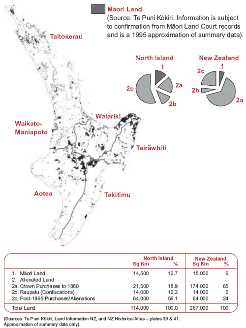
Image source · R19-V23
Office of the Auditor-General New Zealand, based on Te Puni Kōkiri summary data, published 2004.
- Date
- 1995 approximation; published in 2004
- Creator / photographer
- Te Puni Kōkiri data; Office of the Auditor-General publication
- Repository
- Office of the Auditor-General
- Catalogue / reference
- Māori Land Administration: Client Service Performance of the Māori Land Court Unit and the Māori Trustee, Figure 1, p.26
- Copyright / licence
- OAG/Crown publication terms and any Te Puni Kōkiri source-credit requirements must be confirmed before book reproduction.
There is a temptation to describe such a system using the language of a modern enterprise geodatabase. That would flatten the history. DCDB belonged to the technical architecture of its time, with specialist workstations, proprietary software, Oracle, digitising equipment and production practices organised by Land District. The system established a maintained national cadastral database. Staff could maintain the national cadastral map as structured information.
Accuracy and continuity
Sources · 1
3. Accuracy and legal status. Use LINZ cadastral accuracy guidance and reform material for the distinction between topologically complete national parcel representation, map-derived coordinate position and legal or survey evidence. Source-map scales ranged roughly from 1:400 to 1:50,000. Transformation or digitising did not convert compiled record-map geometry into survey-accurate legal boundaries.
The weakest part of a paper cadastral record map could become the most misleading part of the digital system because the screen removed many of the visual clues about its origin. Record maps had been compiled at very different scales. LINZ’s later accuracy guidance gives a range from roughly 1:400 in dense urban areas to 1:50,000 in remote rural areas. At 1:50,000, a plotting displacement of only one millimetre on the map represents about fifty metres on the ground. A crisp digital line could therefore carry an uncertainty much larger than its appearance implied. Zooming in made the line bigger while leaving the nineteenth- or twentieth-century evidence underneath it unchanged.
Digitising preserved much of that inherited positional error and could add a little more. The operator had to locate the paper line with a cursor, register the sheet correctly and work with whatever generalisation, distortion or compilation error was already present. More decimal places in the stored coordinates did not add more truth. Computers are particularly good at giving weak source material a very tidy haircut.
The national database nevertheless could be topologically complete. Parcel polygons could close, shared boundaries could connect and the system could know which parcels sat next to one another. That kind of structural consistency is useful for indexing, GIS overlay, property administration and data distribution. Survey accuracy instead concerns where the boundary lies in relation to survey marks, observations, bearings, distances and the legal survey record. The two ideas overlap, but they are not interchangeable.
New surveys allowed some DCDB geometry to improve over time, but the uneven quality remained a system-level limitation. Users who treated the parcel layer as a convenient base map could work productively with it. Users who assumed the displayed coordinates were equivalent to cadastral survey evidence could get into trouble. The shift from paper to digital had made the cadastre easier to see and reuse. It had not repealed measurement error.
Precision on the screen
For ordinary GIS work the distinction between cadastral representation and legal boundary could be easy to miss. A user could zoom in, overlay an aerial photograph, add a planning zone and measure a distance with a cursor. The software would return a number whether or not the source geometry justified it. The database had made calculation easy before it had made every coordinate equally reliable. That is a recurring problem in digital mapping: a system can calculate far more precisely than its source data was ever observed.
Surveyors approached the same parcel from a different evidential direction. They could use the digital cadastre to locate relevant parcels and surveys, but boundary definition depended on the cadastral survey record, marks on or related to the ground, legal principles and professional judgement. Where parcel coordinates disagreed with better survey information, users needed to check the underlying survey records. Landonline’s conversion work addressed these differences in positional accuracy.
The uneven accuracy also affected downstream overlay. A planning or environmental layer might have its own positional limitations, while an orthophoto could be more or less accurate depending on its control and production. Overlaying all three could create slivers and apparent encroachments that were artefacts of different datasets rather than real conditions on the ground. DCDB users needed metadata, experience and restraint. National digital availability made comparison easier, but comparison could expose differences that paper workflows had kept in separate drawers.
Wider use of parcels
Once parcel geography existed as maintained digital data, other organisations wanted it. Councils could align property, rating, planning and asset information with parcels. Utilities could use cadastral context around network assets. Government agencies and consultants could organise environmental, statistical or administrative information against a common land framework. Property systems could use the parcel database as an index to other records. The cadastre was becoming infrastructure for people who had no role in maintaining cadastral surveys.
That wider use introduced another layer between Crown custody and the end user. Historical DCDB documentation records a licensed-distributor model in which bulk data could be supplied to organisations including Terralink, New Zealand Aerial Mapping, Eagle Technology, MapInfo Australia, Critchlow Associates and Map Data Sciences. Distributors translated formats, packaged data and supported customers. Chapter 12 follows those firms as part of the GIS industry. Here their role is narrower: a national cadastral database had become valuable enough to support a commercial distribution and translation market around it.
Charges and licences were part of that environment. The historic documentation records per-feature charging and distributor arrangements that made national or regional data access a real cost. The full pricing story belongs later in the book, when Crown information policy and open data become the subject. For the cadastre, the distribution model shows how far the database had moved beyond internal production. Organisations were paying to use a digital parcel framework because reproducing it themselves would have been absurd.
The growing dependence also made maintenance more consequential. A parcel database used only to print an internal map can tolerate different failure modes from a dataset that supports property systems, planning analysis and data products across the country. Updates, identifiers, topology and lineage became part of the value. The national cadastre was no longer only a survey-office record. It had become a shared dependency.
The cadastral base
The parcel layer’s usefulness came partly from its ability to connect otherwise unrelated information. A council property record, a valuation entry, a planning rule or an asset could be associated with a parcel identifier or spatially related to parcel geometry. A utility did not need the cadastre to define its pipes or cables, but parcels provided familiar land context around the network. Environmental analysts could aggregate or intersect information by property. The digital cadastre became a common organising frame because land administration touched so many other databases.
That reuse also created expectations the original record maps had never been designed to meet. A customer might want a whole region in one coordinate system, refreshed regularly and supplied in the format required by its GIS. Another might want attributes stripped down to a small set for a desktop application. A national database could support those demands because the information had been separated from the fixed paper sheet. Distribution firms and internal data teams could translate and package it rather than redrawing the geography.
The relationship between authority and convenience needed constant care. DCDB was an official maintained Crown cadastral information system within its defined role, but that did not make every coordinate definitive evidence of a legal boundary. Downstream users often wanted one simple parcel layer to behave as both index and survey truth. The history of the digital cadastre is partly the history of managing that expectation.
A department is split
Institutional change arrived before the next technical system was ready. On 1 July 1996 the Department of Survey and Land Information was divided. Land Information New Zealand was created as a government department responsible for core Crown land-information and regulatory functions, while commercial mapping and land-information activities moved to Terralink. The similarly named ‘old LINZ’ standards advisory body that had existed from 1987 was a different organisation and was dissolved during the restructuring.
For the cadastre, the division separated public authority from some of the commercial machinery around production and distribution. LINZ retained responsibility for the survey and title systems and the standards that underpinned them. Terralink carried commercial mapping, data and production capability into the new structure and became involved in major conversion work. Customers could encounter Crown data through commercial channels, but the commercial supplier did not thereby become the cadastral authority.
The split also occurred just as the limitations of the existing digital arrangement were becoming harder to ignore. DCDB had solved the enormous problem of creating a national parcel framework, but it had not integrated every survey and title process into one electronic environment. Paper plans and legal records still carried information that the parcel database alone could not replace. A digital cadastre existed. The next task was to rebuild the surrounding land-information system around digital records and transactions.
Survey conversion
The Survey Conversion Project connected DCDB with Landonline. LINZ’s accuracy history states that the positional quality of the DCDB was not sufficient to realise all of the benefits expected from the new system. Conversion therefore used parcel dimensions, including bearings and distances from survey records, to improve the digital cadastre in many intensively surveyed areas. The process combined a cleaner national parcel representation with structured cadastral data and new maintenance workflows. It returned to survey evidence that had always been richer than the map-derived coordinates.
This is a useful reversal in the digital story. The 1980s programme had taken the national record-map fabric and converted it into structured coordinates. The later conversion work then used survey dimensions and other evidence to strengthen those coordinates. Digital infrastructure did not eliminate the older survey archive. It made the archive newly useful as input to improving the database.
Contemporary Landonline papers describe other conversion streams running alongside the spatial work. Existing survey plans were imaged and linked so they could be accessed electronically. Geodetic information was loaded into the new environment. Title records were converted into electronic computer registers between 1999 and 2002. DCDB information from the Land Districts was transformed into the new Landonline structures. Chapter 14 follows those processes in detail. In Chapter 13 they mark the point where a parcel database begins to become part of a wider electronic survey and title system.
Cadastral services
Landonline’s design widened the unit of automation. DCDB had concentrated on the spatial cadastral framework and associated indexes. Landonline was intended to integrate survey and title processes, bringing together spatial data, survey records and the land register within an electronic operating environment. That difference is why the change cannot be described as a simple database upgrade. The new programme reached into professional transactions and legal records as well as map-derived geometry.
Survey-plan imaging shows the scale of that expansion. Contemporary 2002 programme papers describe about 1.2 million existing survey plans being scanned from microfilm or original plans and loaded into Landonline, with images linked to their plan references and spatial location. Staff selected the survey observations and relationships needed for the new system. It was to make the source survey record available electronically and connect it to the spatial index. Digital access and digital capture were separate choices.
Titles followed their own conversion path. Certificates of title and related records were transformed into electronic computer registers between 1999 and 2002. Title information concerns legal ownership and registered interests, while cadastral survey information concerns the location and definition of land boundaries. Landonline brought those previously distinct record systems into a shared electronic service without erasing the distinction between them. Chapter 14 follows how that changed transactions for surveyors, lawyers, conveyancers and LINZ staff.
The handover happens district by district
Sources · 1
5. Survey Conversion and retirement of DCDB. Use LINZ accuracy guidance, contemporary cadastral automation papers and official Landonline historical records for Survey Conversion and the district-by-district cessation of DCDB maintenance from Otago on 30 March 2000 through North Auckland on 22 March 2002. This is the bridge to Chapter 14, not a second Landonline narrative.
There was no national midnight when DCDB disappeared and Landonline took over. LINZ records the first Landonline rollout in Otago in April 2000. DCDB maintenance stopped in Otago on 30 March 2000, then in Southland and Canterbury later that year. Nelson, Westland, Marlborough, Wellington, Gisborne, Hawke’s Bay, South Auckland and Taranaki followed during 2001. North Auckland was the last district, on 22 March 2002.
The transition involved several stages of conversion. For almost two years New Zealand was moving through different cadastral production states depending on the Land District. Staff, contractors, surveyors and downstream data users had to work through a staged migration rather than a single replacement. Data conversion, quality improvement, business change and system rollout overlapped. The old database remained historically relevant even after a district stopped maintaining it because the lineage of Landonline parcel data still led back through DCDB to the maps and surveys from which it had been built.
The wider Landonline programme encountered difficulties. Terralink signed a major subcontract with EDS in 1999 and entered receivership in January 2001 after serious losses associated with that work. The commercial and programme history deserves its own treatment, because it involves project estimates, contracting, organisational change and a national transaction system rather than only cadastral conversion. Chapter 14 takes up that story. Replacing the national system involved data conversion, new working methods and continued service delivery.
Uses of cadastral data
By March 2002 the national cadastral production environment had crossed another threshold. The original record maps, survey plans, field evidence and legal instruments still carried the authority from which the cadastre had been built. The operational centre of gravity had moved. Parcel geometry, survey references and related records increasingly lived inside a national electronic system that could be maintained and accessed without returning first to a particular paper sheet.
DCDB had done the difficult middle work. It took cadastral mapping created for human reading and turned much of it into reusable structured geography. It made national continuity possible, created a common parcel framework for other GIS and exposed the consequences of carrying old positional uncertainty into digital systems. Its imperfections were not evidence that digitisation had failed. They were evidence that the source cadastre contained histories of scale, measurement, compilation and maintenance that a database could reveal but not magically erase.
The next system attempted something larger than a better parcel map. Landonline sought to integrate the spatial cadastre with survey and title records and the transactions that changed them. That required different technology, different business rules and a much larger change in professional practice. The parcel had become data. Surveying and title registration now had to become digital as well.