Image archive Image details
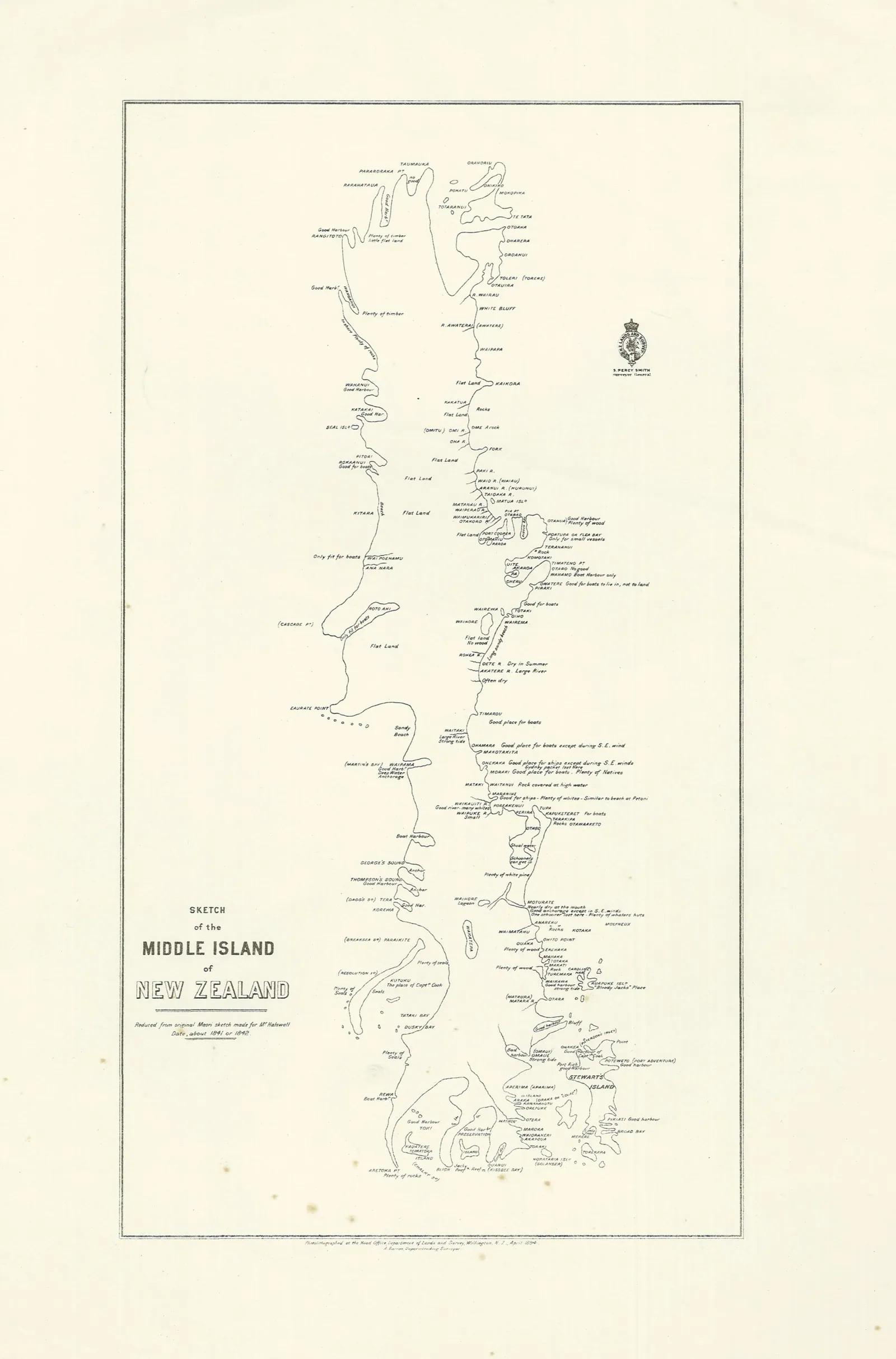
Māori-sourced map of the South Island and Rakiura, c.1841
About this image
A historical map derived from an unidentified Māori/Kāi Tahu sketch and colonial transcription, evidence of place knowledge and its representation. This predates GIS and is not the Kā Huru Manu atlas.
Connected records
- te runanga o ngai tahu ngai tahu archive · Image subject or related institution; see context for limitations
Attribution
Source and reuse
- Published on
- Wikimedia Commons
- Credit
- Unidentified Ngāi Tahu/Kāi Tahu source of original sketch; Edmund Halswell (c.1841 transcription); Lands and Survey (later lithography); image published by Archives New Zealand
- Image date
- c.1841 map; 2015 Commons publication
- Original file source
- View the source-original image
- Original source filename
- File:File:Māori map of the Middle (South) Island and Stewart Island, c.1841 (19532914794).jpg
- Original dimensions
- 3038 × 4609 pixels
- Original SHA-256
f62199553c0b003f121f1514ec2698eb9e6f09ce54fb6c1c4270e2a0e41fe685- Reuse conditions
- Publisher's licence statement
- Display preparation
- Original unchanged JPEG archived in the Wave 4 research package; the website uses uncropped WebP display and card derivatives. Original and crop licensing per Commons file page; no cropping performed.
- Local copy
- The reader displays a local copy so the image remains available if the original page changes.