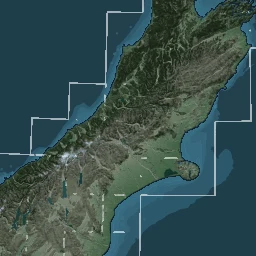
A separate DOC-hosted cached terrain display credited to Geographx, labelled as 10 m resolution in its ArcGIS metadata.
The Department of Conservation's ArcGIS Server publishes Terrain/Geographx10m, a cached terrain map display whose service description specifies 10 m resolution and whose copyright line credits Geographx. The published map-service metadata declares NZTM2000 (EPSG:2193) and tiled imagery.
A map-cache service is different from a source DEM. The service metadata does not establish when the imagery was first produced, how its '10 m' designation was defined, whether it used the 2012 8 m DEM, or its complete processing and licensing history. Its map images are not automatically authorised for republication by the separate open licence on the LINZ 8 m DEM; the historical site links the service instead of copying its tiles.
Sources · 2
- Department of Conservation, Terrain/Geographx10m ArcGIS MapServer
- Roger Smith, Designing Raster Base Maps with Photoshop, 8th Mountain Cartography Workshop, 2012, pp 101–106
Related source links · 2
Sources and further reading · 2
- Department of Conservation, Terrain/Geographx10m ArcGIS MapServer
- Roger Smith, Designing Raster Base Maps with Photoshop, 8th Mountain Cartography Workshop, 2012, pp 101–106