Image archive Image details
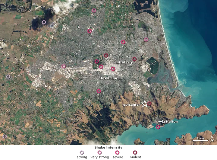
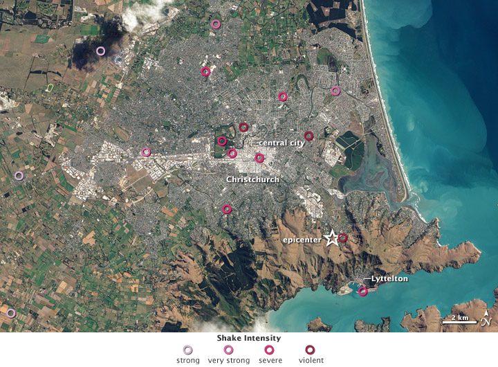
Mapping Christchurch earthquake shaking, March 2011
About this image
Retrospective analytical earthquake map.
Download the original locally stored image
Attribution
Source and reuse
- Published on
- Wikimedia Commons
- Credit
- NASA Earth Observatory, Robert Simmon; EO-1 ALI data and USGS Earthquake Hazard Program; legend adapted by Wikimedia contributor Avenue
- Image date
- 4 March 2011 (imagery); published 9 March 2011
- Original source filename
- File:Christchurch from space, 4 March 2011, showing quake shaking strength, with key.png
- Original dimensions
- 720 × 530 pixels
- Original SHA-256
8969427165821527c534dabf9a3f443aa959277c2068742537c1a03cb42b3b50- Local copy
- The reader displays a local copy so the image remains available if the original page changes.