Image archive Image details
Sentinel satellite analysis of Cyclone Gabrielle flooding near Napier, 2023
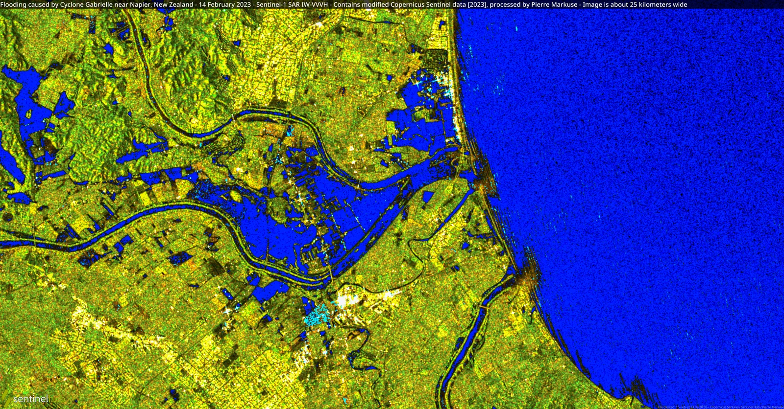
About this image
Image depicts the actual 2023 cyclone flooding relevant to the emergency period. It does not document the content, software or results of the NZTA operational platform discussed in the linked historical event.
Read the illustrated passage in Disaster response and live mapping →
Download the original locally stored image
Attribution
Source and reuse
- Credit
- Pierre Markuse; contains modified Copernicus Sentinel data [2023]. Source material distributed via Wikimedia Commons under CC BY 2.0; WebP versions resized without cropping.
- Image date
- 15 February 2023 (processed satellite image; depicts February 2023 flooding)
- Original file source
- View the source-original image
- Original source filename
- File:Flooding caused by Cyclone Gabrielle near Napier, New Zealand - 14 February 2023 (52690129056).jpg
- Original dimensions
- 9930 × 5190 pixels
- Original SHA-256
026936cc5c2c050fe69d61fee4426d2b26c772f437e61fb8e57cfba77e2433b8- Licence
- CC BY 2.0
- Reuse conditions
- Publisher's licence statement
- Display preparation
- Local original stored unchanged; WebP display width up to 1600 pixels and thumbnail width up to 720 pixels, resized without cropping.
- Local copy
- The reader displays a local copy so the image remains available if the original page changes.