Image archive Image details
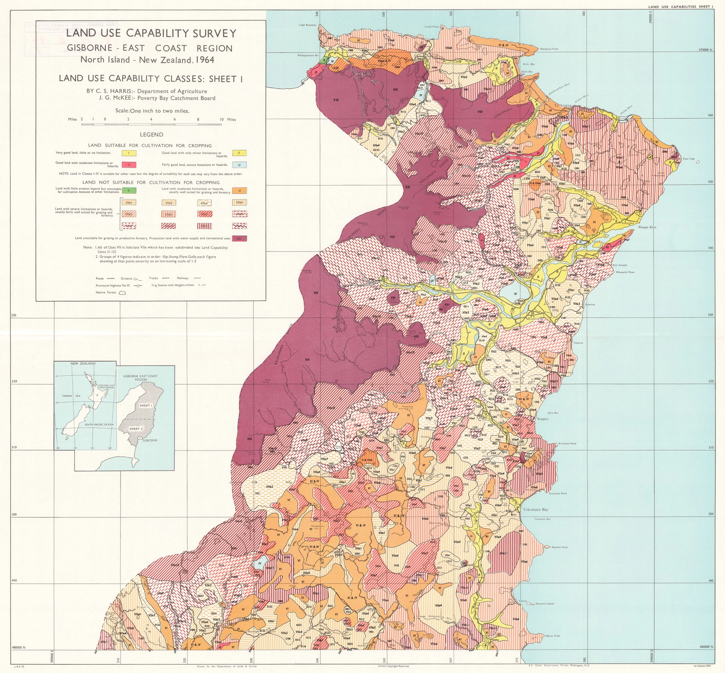
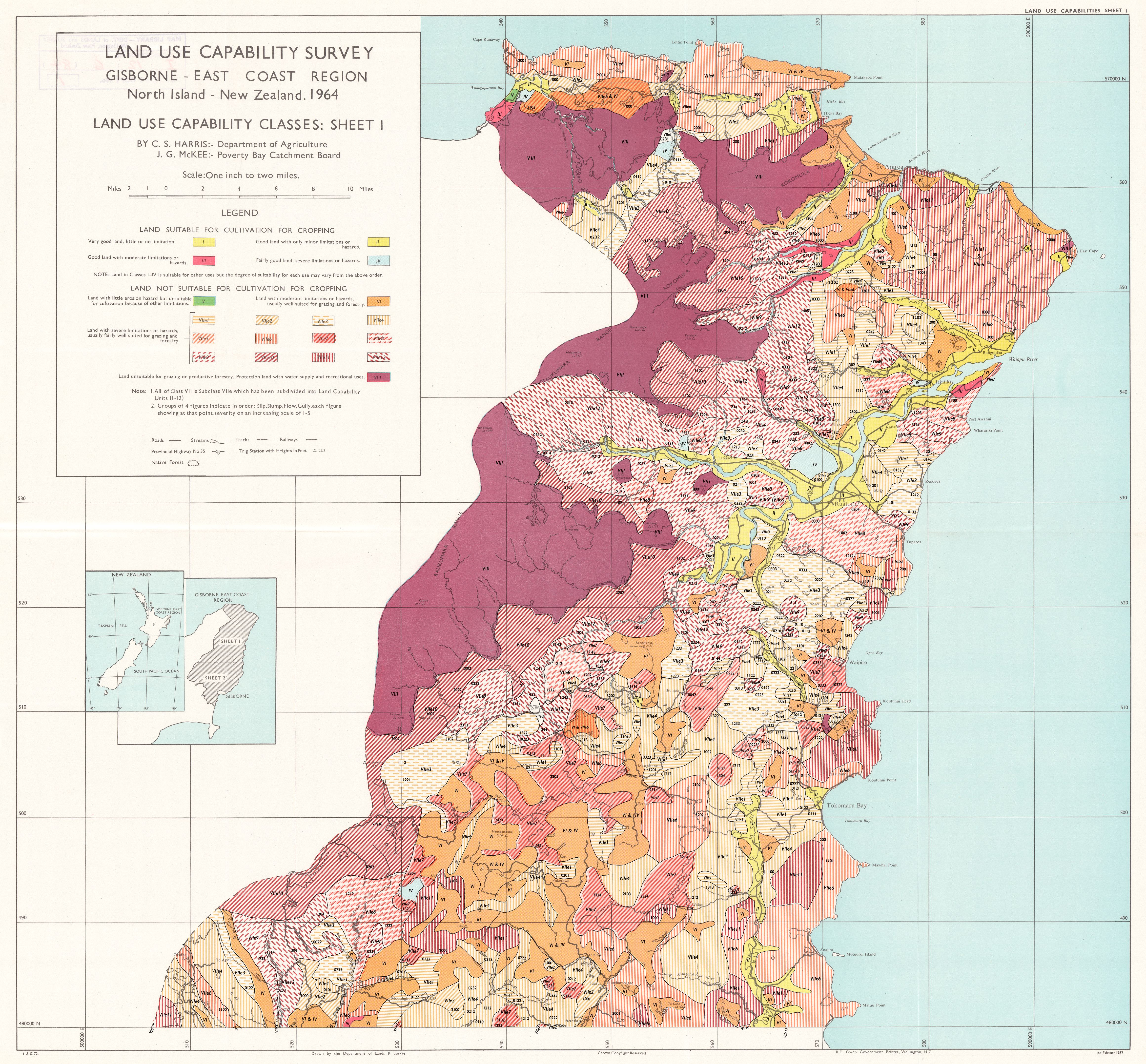
Gisborne–East Coast Land Use Capability classes, sheet 1, 1967
About this image
The catalogue describes six sheets: two LUC class sheets by C. S. Harris and J. G. McKee, two recommended-land-use sheets by C. S. Harris, and two rock-erodibility sheets by T. N. O’Byrne. This image is LUC classes sheet 1 only. Drawn by the Department of Lands and Survey and published in Wellington in 1967, the map bears 1964 in its title and a one-inch-to-two-miles scale (1:126,720). The University of Auckland made the electronic reproduction of a LINZ original in 2014; the catalogue records a 600 ppi TIFF archive. The currently delivered archival file is JPEG 2000, 18,557 × 17,240 pixels. The downloadable local JPEG is the unchanged 4,640-pixel IIIF access copy. The full archival download is linked under Original source file. The 1967 map documents the eight-class Land Use Capability scheme and predates the first-edition NZLRI mapping programme of 1973–1979.
Read the illustrated passage in Land assessment →
Download the original locally stored image
Attribution
Source and reuse
- Credit
- Sourced from LINZ. Crown Copyright reserved.
- Image date
- 1967 publication; 1964 in the survey title; scanned in 2014
- Original file source
- View the source-original image
- Original source filename
- LS072_1_luc_1967_600ppi
- Original dimensions
- 4640 × 4310 pixels
- Original SHA-256
0a632c655caa986a447c67f65dd16437bfafbf167e3f419326406667d29ba22e- Reuse conditions
- Publisher's licence statement
- Display preparation
- The 4,640 × 4,310 JPEG was received unchanged from the National Library IIIF service. WebP display 2,400 pixels wide and card 720 pixels wide, no cropping or recolouring. The best delivered archival JP2 is separately retained, with its checksum recorded.
- Local copy
- The reader displays a local copy so the image remains available if the original page changes.