Image archive Image details
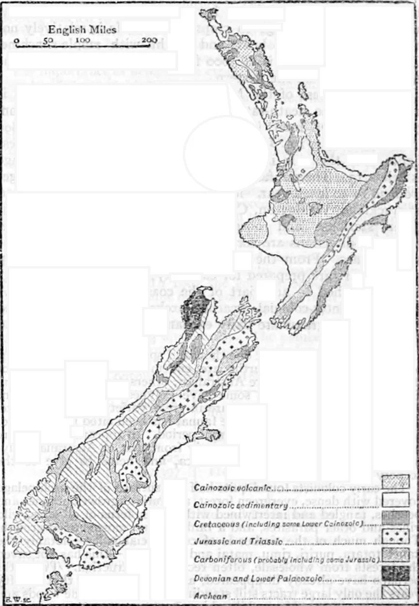
James Hector's geological map of New Zealand
About this image
An early example of nationally organised thematic geographic information. It predates computer mapping.
Download the original locally stored image
Attribution
Source and reuse
- Published on
- Wikimedia Commons
- Credit
- James Hector; engraved by Emery Walker; Encyclopaedia Britannica, 11th edition, volume 19, p. 625
- Image date
- 1884 (map); 1911 (publication)
- Original source filename
- File:EB1911 New Zealand - geological map.jpg
- Original dimensions
- 864 × 1250 pixels
- Original SHA-256
a08463225150b092b3cfbec107222305ab249efaee36125331195762612b9f9f- Licence
- Public domain
- Local copy
- The reader displays a local copy so the image remains available if the original page changes.