Image archive Image details
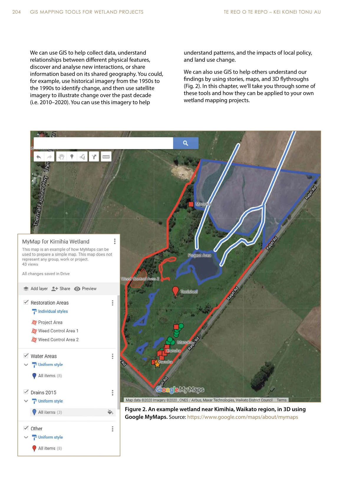
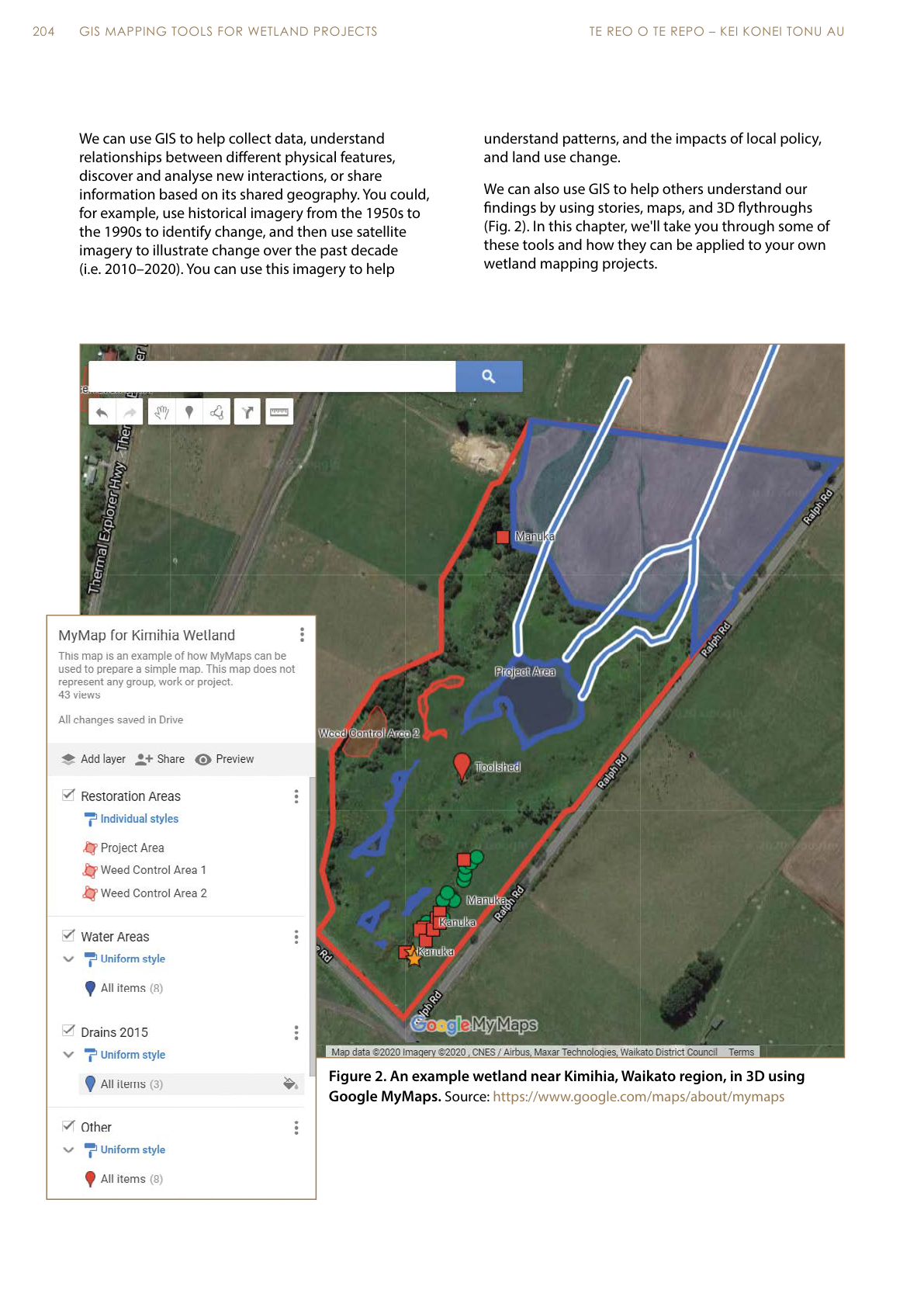
Kimihia wetland mapping example published in 2021
About this image
A Google MyMaps wetland mapping example near Kimihia in Wilkins’s 2021 chapter. PDF p. 4, printed p. 204. The source caption identifies Google MyMaps; no independent screenshot capture date is established.
Read the illustrated passage in Conservation and environment →
Download the original locally stored image
Attribution
Source and reuse
- Published on
- GIS mapping tools for wetland projects, Te Reo o te Repo: Kei Konei Tonu Au, Chapter 16, PDF p. 4
- Credit
- Duane Wilkins; published by Manaaki Whenua – Landcare Research; Google Earth and the imagery/data credits retained in the original screenshot
- Image date
- 2021 (publication date)
- Original dimensions
- 1191 × 1684 pixels
- Original SHA-256
fb15befeb6f3ad753a280dc91c97025336a856dcd2fd322c65f8228e0125f9f9- Display preparation
- Full original PDF page rendered at 144 dpi; web and card derivatives are uncropped. Original publication remains available as an unchanged file.
- Local copy
- The reader displays a local copy so the image remains available if the original page changes.