Image archive Image details
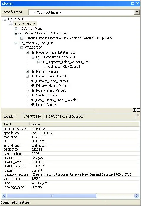
ArcMap Identify panel with related New Zealand parcel records
About this image
A genuine New Zealand desktop GIS screenshot preserved in a LINZ guide explaining file-geodatabase table relationships. The capture date is not independently confirmed, and it does not purport to show the first desktop GIS rollout.
Connected records
- Land Information New Zealand (LINZ) · Source organisation and publisher
Download the original locally stored image
Attribution
Source and reuse
- Published on
- Toitū Te Whenua Land Information New Zealand
- Credit
- Source: Toitū Te Whenua Land Information New Zealand, licensed for re-use under Creative Commons Attribution 4.0 International (CC BY 4.0). Web display copy resized and converted to WebP.
- Image date
- Published by LINZ by 2022; example files dated 2016
- Original file source
- View the source-original image
- Original source filename
- owner_and_stat_action.png
- Original dimensions
- 477 × 693 pixels
- Original SHA-256
9616ddc44af005e1054933834370b297d03cd615677fa6f3e3b3d7cf07be52ca- Licence
- CC BY 4.0
- Reuse conditions
- Publisher's licence statement
- Display preparation
- Local original stored unchanged; WebP display width up to 1600 pixels and thumbnail width up to 720 pixels, resized without cropping.
- Local copy
- The reader displays a local copy so the image remains available if the original page changes.