Image archive Image details
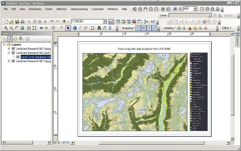
ArcMap displaying Manaaki Whenua WMS land-cover layers
About this image
An authentic ArcMap GIS interface using a live New Zealand WMS data service. Chapter 21 discusses distributed datasets, coordination and standards; the screenshot is a later implementation example.
Read the illustrated passage in Spatial data infrastructure →
Download the original locally stored image
Attribution
Source and reuse
- Published on
- Manaaki Whenua Landcare Research
- Credit
- Manaaki Whenua Landcare Research; basemap includes LINZ source data.
- Image date
- ArcGIS 10.0 tutorial; exact capture date unstated
- Original file source
- View the source-original image
- Original source filename
- 5aa673149fb4422a98265a0763c09dac.jpg
- Original dimensions
- 990 × 620 pixels
- Original SHA-256
655ae1ae8cafc68834e8f4292a465a10a4921facddef32cfb7ef5fd7caf12f3c- Reuse conditions
- Publisher's licence statement
- Display preparation
- Publisher original preserved unchanged locally; WebP reading and card versions resized without cropping. Captured software date and case-study context remain qualified.
- Local copy
- The reader displays a local copy so the image remains available if the original page changes.