Image archive Image details
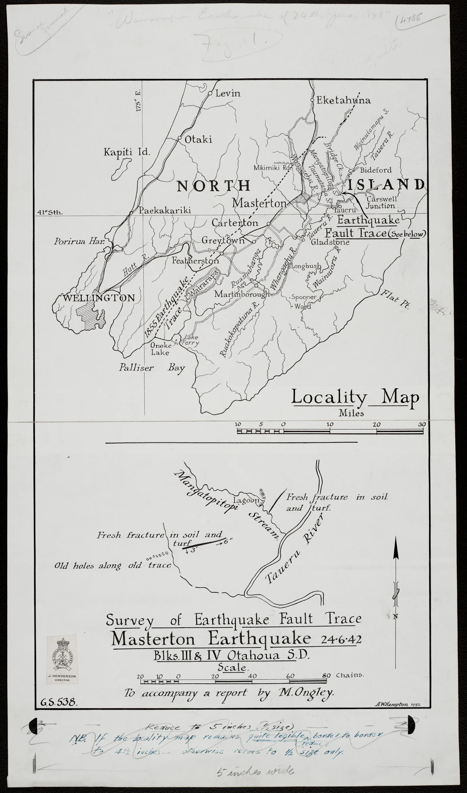
Survey of fault traces following the Masterton earthquake, 1942
About this image
An original pre-GIS disaster/geological survey illustration. It demonstrates mapped earthquake evidence before electronic and real-time mapping; it must not be labelled a live GIS map.
Download the original locally stored image
Attribution
Source and reuse
- Published on
- Wikimedia Commons
- Credit
- Archives New Zealand; original surveyor not identified
- Image date
- 24 June 1942 event; survey document date to verify
- Original source filename
- File:Survey of Earthquake Fault Trace map - Masterton Earthquake (June 24 1942) (18749413649).jpg
- Original dimensions
- 5301 × 8987 pixels
- Original SHA-256
e1c0202674d4a39914b13a0700a6dd7cadbffacbbf4771fe53dd169db69f7d08- Licence
- CC BY-SA 2.0
- Local copy
- The reader displays a local copy so the image remains available if the original page changes.