Image archive Image details
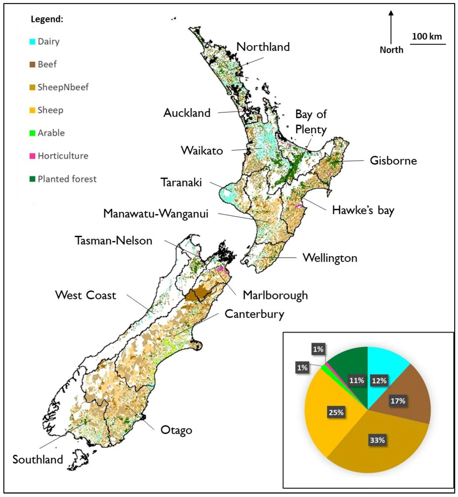
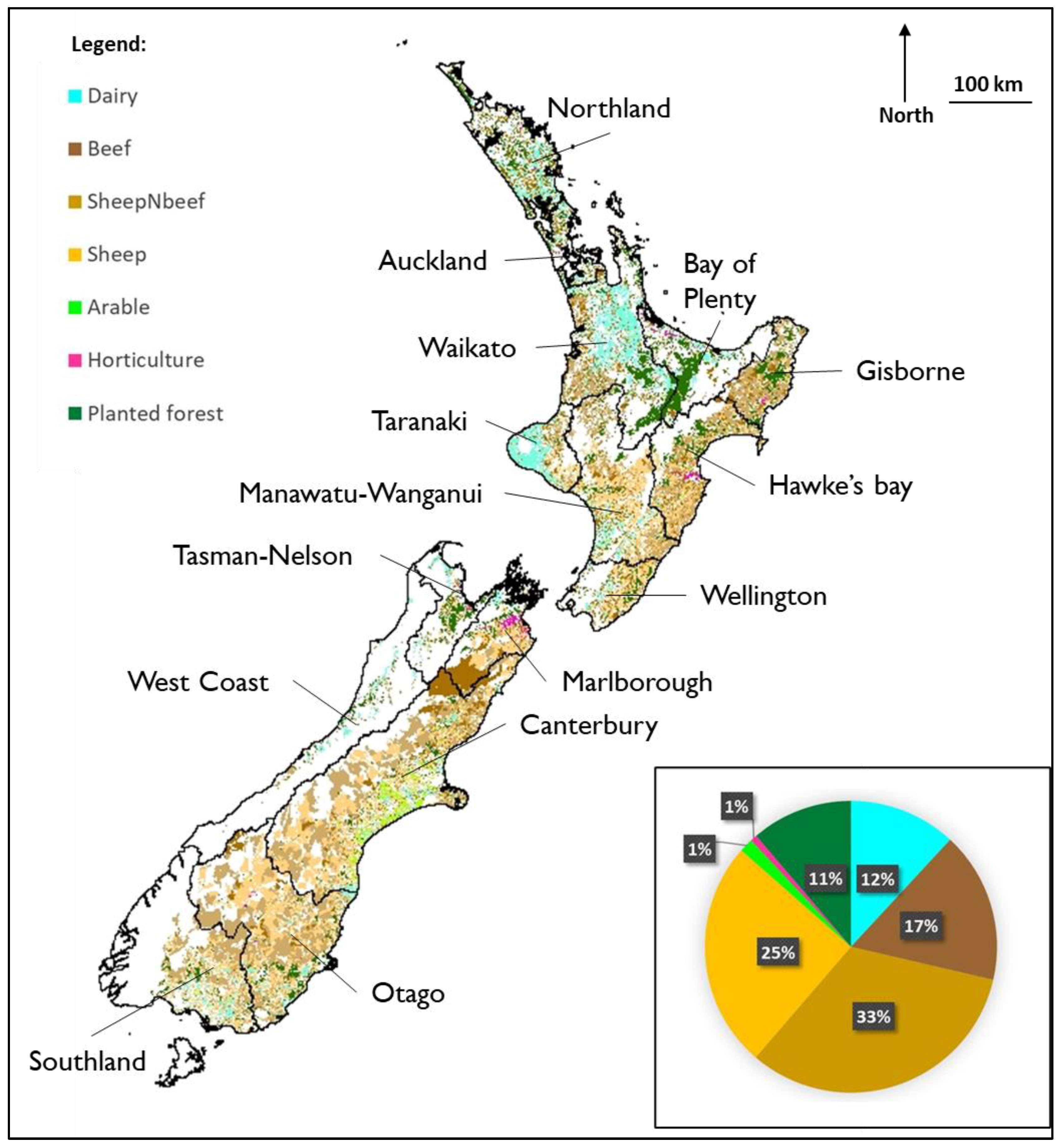
New Zealand agricultural land use mapped with LUC, LUCAS and AgriBase data, 2022
About this image
Figure 1 from Vannier and colleagues (2022). This is an actual geospatial output from New Zealand LUC and other agricultural data, created in 2022. It is not presented as a first-edition NZLRI worksheet, Land Use Capability sheet, or original LADEDA map. The primary figure caption explicitly identifies its datasets.
Read the illustrated passage in Land assessment →
Download the original locally stored image
Attribution
Source and reuse
- Credit
- Clémence Vannier, Thomas A. Cochrane, Peyman Zawar-Reza and Larry Bellamy (2022), Land 11(12), 2334, Figure 1, CC BY 4.0
- Image date
- 19 December 2022
- Original file source
- View the source-original image
- Original source filename
- land-11-02334-g001.png
- Original dimensions
- 3399 × 3682 pixels
- Original SHA-256
31e5cae579e35a59ae860280e35c82c2659bac16c5e3fec4e9f1a53749f89954- Licence
- CC BY 4.0
- Reuse conditions
- Publisher's licence statement
- Display preparation
- Local original stored unchanged; WebP display width up to 1600 pixels and thumbnail width up to 720 pixels, resized without cropping.
- Local copy
- The reader displays a local copy so the image remains available if the original page changes.