Image archive Image details
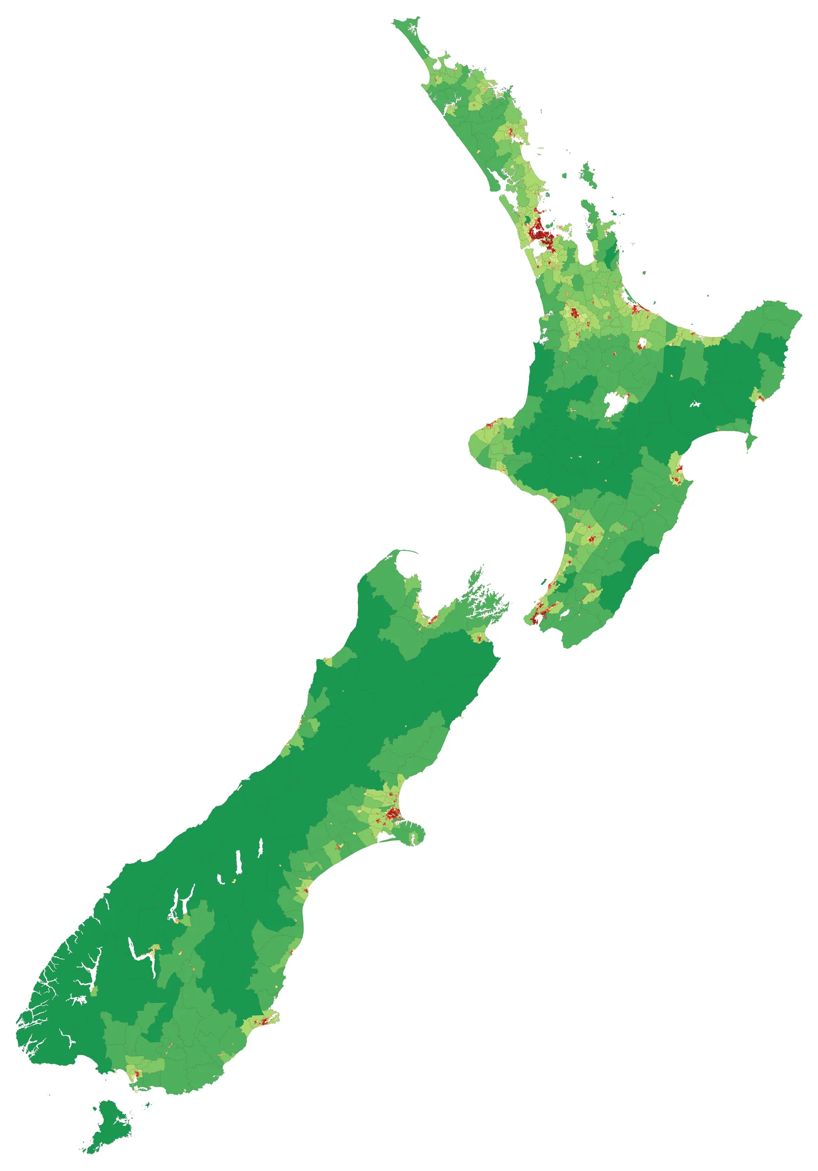
New Zealand census population density by SA2
About this image
A genuine map of census geography and statistical-area units; it shows a later application rather than the original 1940s meshblock definition.
Read the illustrated passage in Census geography →
Download the original locally stored image
Attribution
Source and reuse
- Published on
- Wikimedia Commons
- Credit
- Vardion; Stats NZ 2023 Census and SA2 geographic data; prepared using QGIS
- Image date
- 2023 Census, map produced October 2024
- Original source filename
- File:2023 NZ Census Population Density.png
- Original dimensions
- 5870 × 8400 pixels
- Original SHA-256
05fd358870d8f4a7a1927b0d663318eff9d748194ba35a2093395ac65be23a28- Licence
- CC BY 4.0
- Local copy
- The reader displays a local copy so the image remains available if the original page changes.