Image archive Image details
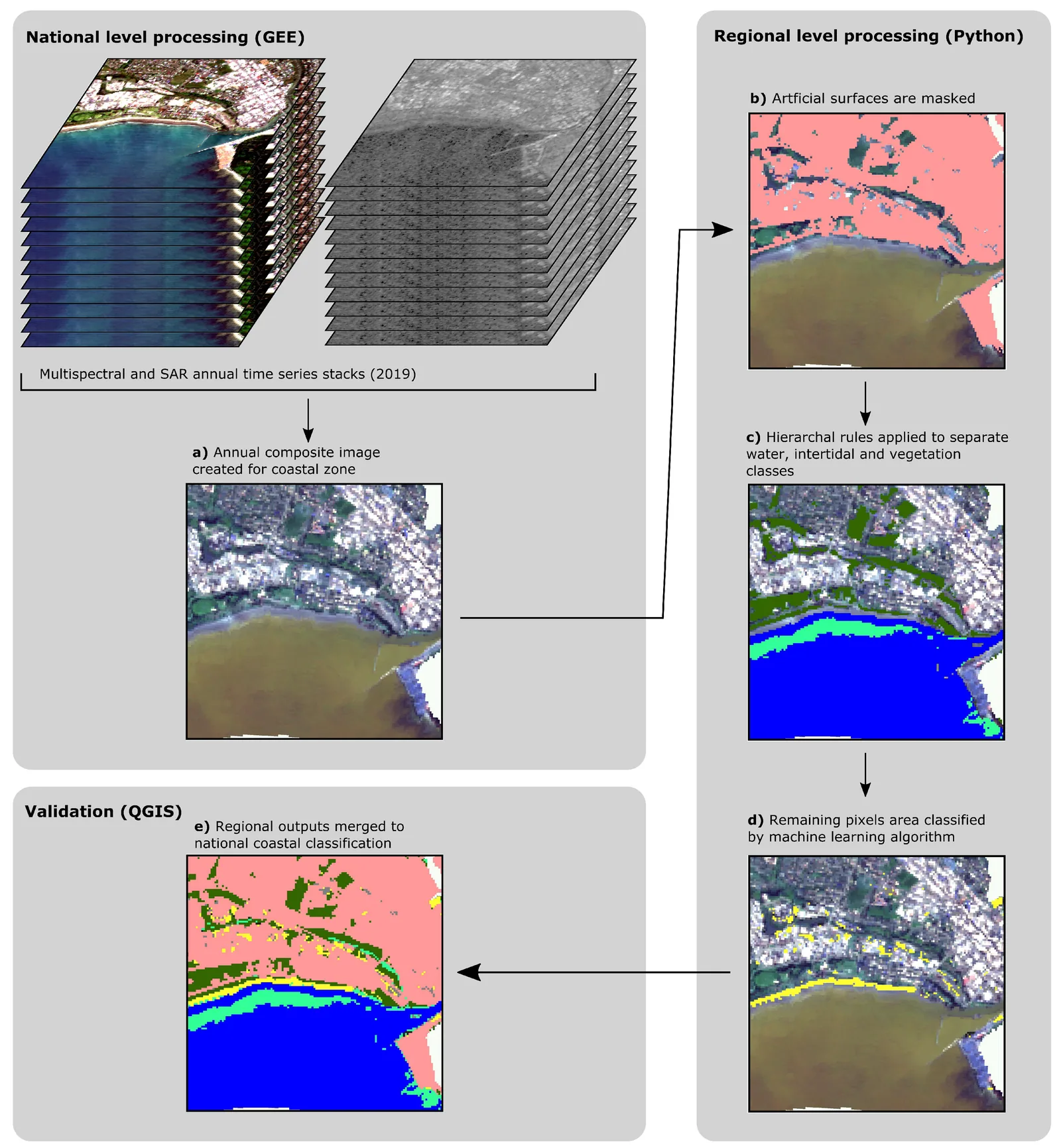
Automated coastal landcover classification workflow, New Zealand, 2022
About this image
Figure 4 from Collings, Ford and Dickson (2022), using Sentinel-1 and Sentinel-2 imagery. Unlike a generic model-builder illustration, this documents a real New Zealand automated geospatial research workflow. It is not claimed to be an earlier NIWA or local-council processing workflow.
Read the illustrated passage in GIS automation →
Download the original locally stored image
Attribution
Source and reuse
- Credit
- Benedict Collings, Murray Ford and Mark Dickson (2022), Remote Sensing 14(19), 4827, Figure 4, CC BY 4.0
- Image date
- 2022 (published September 2022)
- Original file source
- View the source-original image
- Original source filename
- remotesensing-14-04827-g004.png
- Original dimensions
- 2968 × 3213 pixels
- Original SHA-256
baef8f06103a3f5264befc30f81e98225b4aadfd289f0dc740f363a0de731b94- Licence
- CC BY 4.0
- Reuse conditions
- Publisher's licence statement
- Display preparation
- Local original stored unchanged; WebP display width up to 1600 pixels and thumbnail width up to 720 pixels, resized without cropping.
- Local copy
- The reader displays a local copy so the image remains available if the original page changes.