Image archive Image details
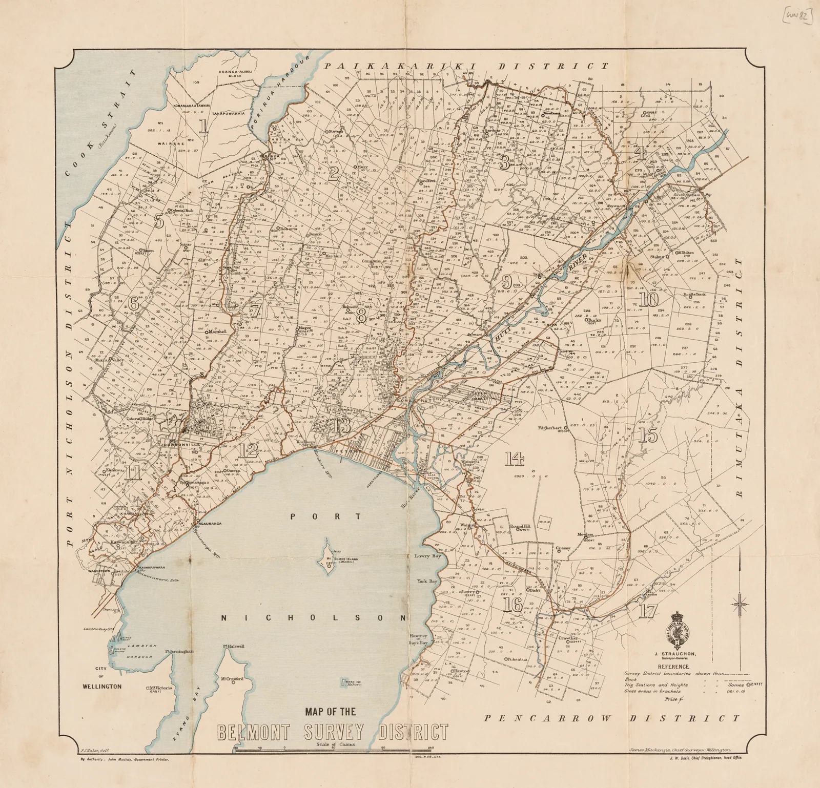
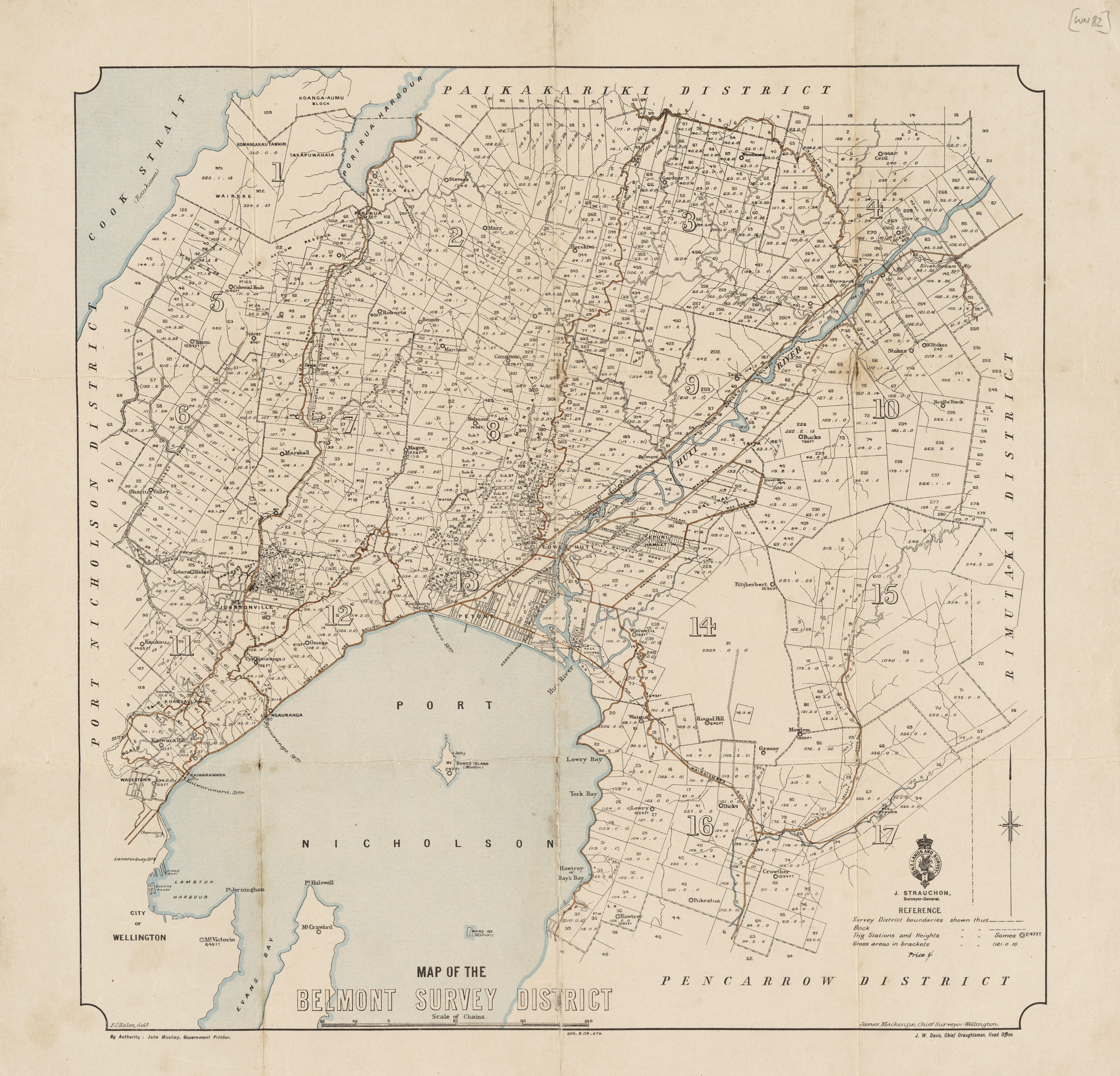
Petone and Lower Hutt survey map with trig stations, 1909
About this image
Specific historical example of the trig controls and spatial records that were used before electronic coordinate computation.
Download the original locally stored image
Attribution
Source and reuse
- Published on
- Wikimedia Commons
- Credit
- J. W. Davis, Chief Draughtsman, New Zealand Department of Lands and Survey
- Image date
- 1909
- Original source filename
- File:1909 Map of Petone and Lower Hutt NZMS013 WN82.jpg
- Original dimensions
- 5075 × 4876 pixels
- Original SHA-256
9aad480062b5c23b699d4577de8edf50ce9d6344d61489eca0d89a23f5968df9- Licence
- CC0
- Local copy
- The reader displays a local copy so the image remains available if the original page changes.