Image archive Image details
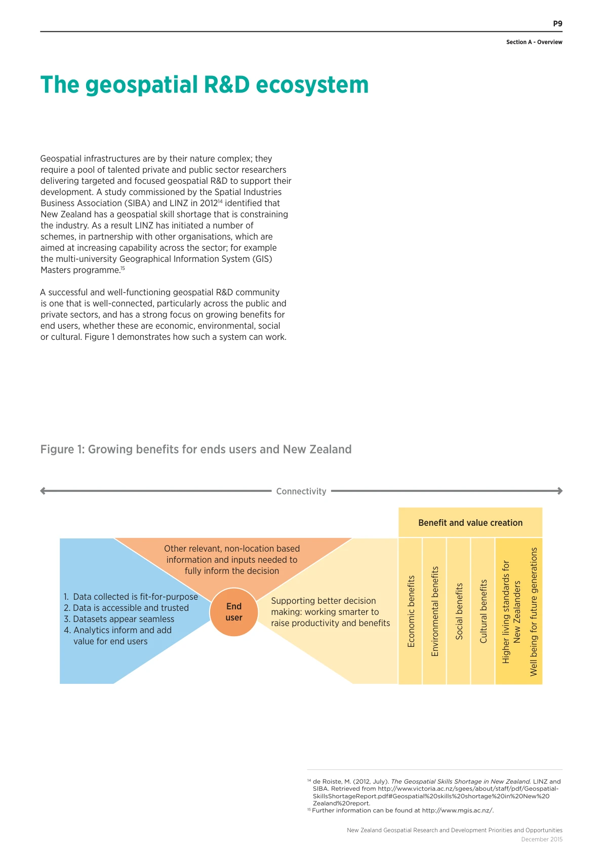
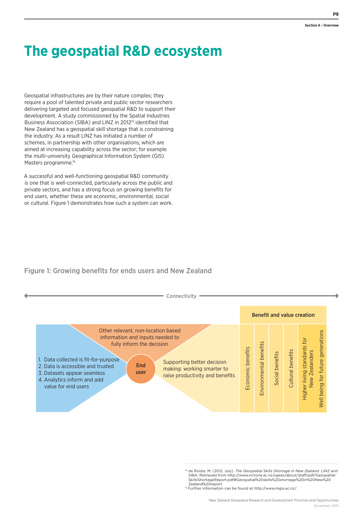
Geospatial research and end-user benefits, 2015
About this image
LINZ’s framework joining fit-for-purpose data, trusted access, seamless datasets and analytics with end-user decisions. PDF p. 11, printed p. 9, December 2015.
Read the illustrated passage in University teaching and research →
Download the original locally stored image
Attribution
Source and reuse
- Published on
- New Zealand Geospatial Research and Development Priorities and Opportunities 2016–2020: Section A, PDF p. 11
- Credit
- Land Information New Zealand
- Image date
- December 2015 (publication date)
- Original dimensions
- 1191 × 1684 pixels
- Original SHA-256
c49ba9bdd17a9130eb50d9e7bd0fb6bf9565010e85c45f54aa83e725ac7cbb91- Display preparation
- Full original PDF page rendered at 144 dpi; web and card derivatives are uncropped. Original publication remains available as an unchanged file.
- Local copy
- The reader displays a local copy so the image remains available if the original page changes.