Image archive Image details
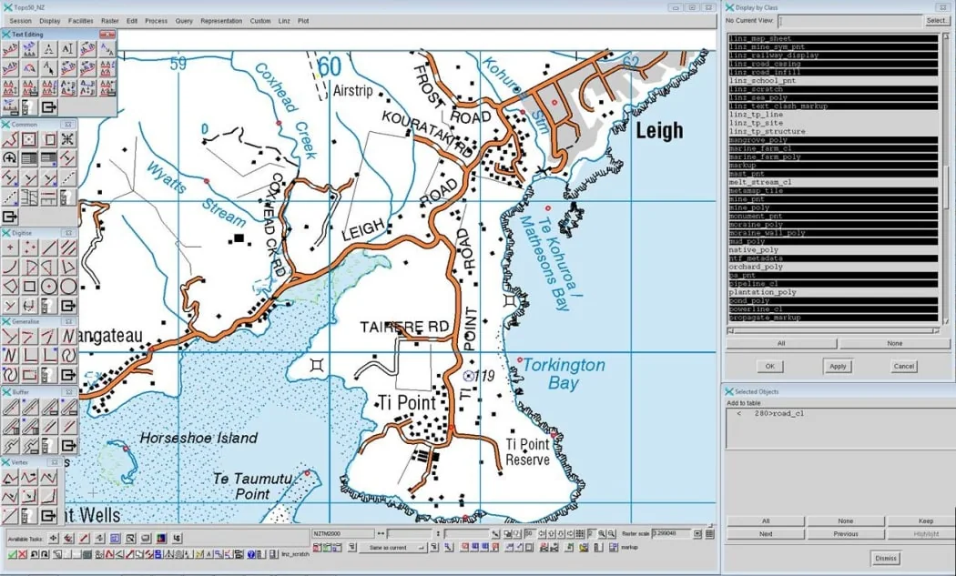
Digital topographic map production on a GIS screen, 2016
About this image
Publisher-dated documentary image from RNZ's 2016 account of contemporary LINZ digital cartography. It does not depict the initial 1970s database conversion.
Read the illustrated passage in Digital topography →
Download the original locally stored image
Attribution
Source and reuse
- Published on
- RNZ / Land Information New Zealand
- Credit
- Land Information New Zealand, image republished by RNZ in Alison Ballance's 21 April 2016 programme.
- Image date
- Published 21 April 2016
- Original file source
- View the source-original image
- Original source filename
- 4OXZJCT_copyright_image_65327
- Original dimensions
- 1050 × 633 pixels
- Original SHA-256
a2ea6179ac4445c7270e9580e0748022a2bf28842d6e8f1dd9c4ec56f5e9ebba- Reuse conditions
- Publisher's licence statement
- Display preparation
- Publisher original preserved unchanged locally; WebP reading and card versions resized without cropping. Captured software date and case-study context remain qualified.
- Local copy
- The reader displays a local copy so the image remains available if the original page changes.