Image archive Image details
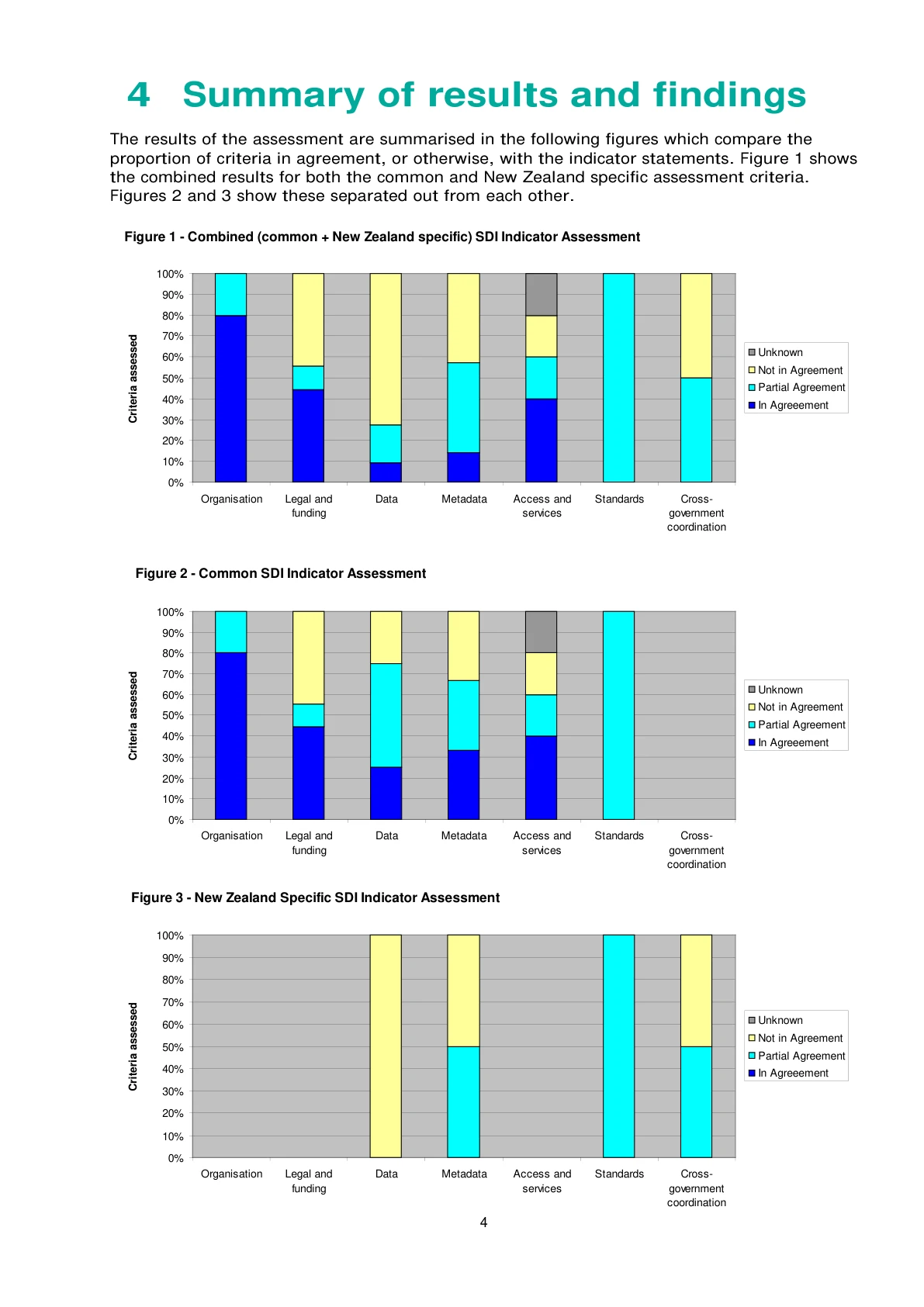
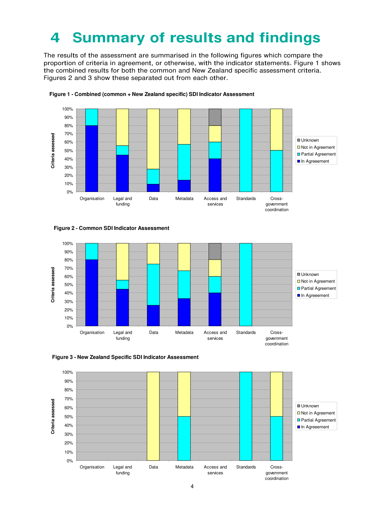
SDI benchmark indicator charts, 2012
About this image
Combined and separate indicator assessments in the December 2012 State of Play report. PDF p. 6, printed p. 4. The assessment baseline is September 2012.
Read the illustrated passage in Spatial data infrastructure →
Download the original locally stored image
Attribution
Source and reuse
- Credit
- New Zealand Geospatial Office, Land Information New Zealand
- Image date
- December 2012 (publication date)
- Original dimensions
- 1191 × 1685 pixels
- Original SHA-256
248f4bc3ff29f9ce3444887139e8b082fc1f48816878dc2cf3c0222076e2ae0f- Display preparation
- Full original PDF page rendered at 144 dpi; web and card derivatives are uncropped. Original publication remains available as an unchanged file.
- Local copy
- The reader displays a local copy so the image remains available if the original page changes.