Image archive Image details
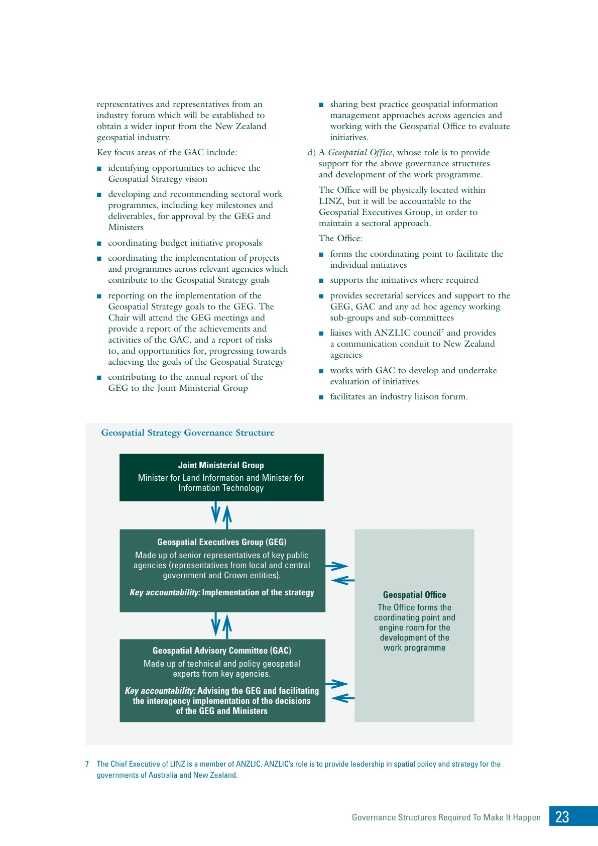
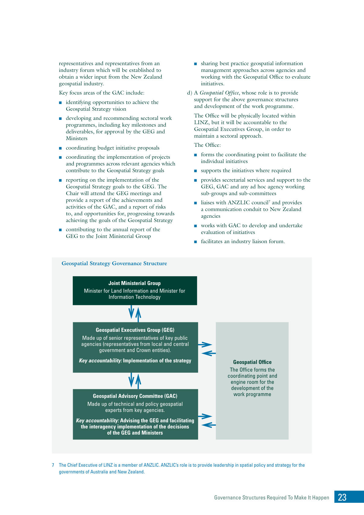
Proposed national geospatial governance, 2007
About this image
The governance structure proposed in the January 2007 strategy. PDF p. 25, printed p. 23. The diagram describes intended arrangements.
Read the illustrated passage in GIS across government →
Download the original locally stored image
Attribution
Source and reuse
- Published on
- Understanding our geographic information landscape: A New Zealand Geospatial Strategy, PDF p. 25
- Credit
- Land Information New Zealand and contributing New Zealand public agencies
- Image date
- January 2007 (publication date)
- Original dimensions
- 1191 × 1684 pixels
- Original SHA-256
6e26e66d004c946dcd0a1d0c6e926ac2a2bf6f35c0648fb6770bb44abbf33246- Display preparation
- Full original PDF page rendered at 144 dpi; web and card derivatives are uncropped. Original publication remains available as an unchanged file.
- Local copy
- The reader displays a local copy so the image remains available if the original page changes.