Image archive Image details
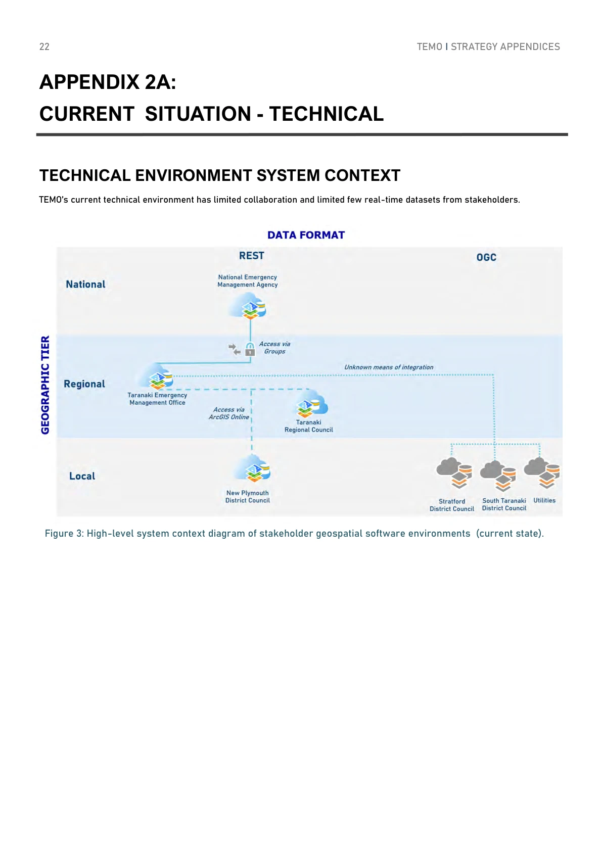
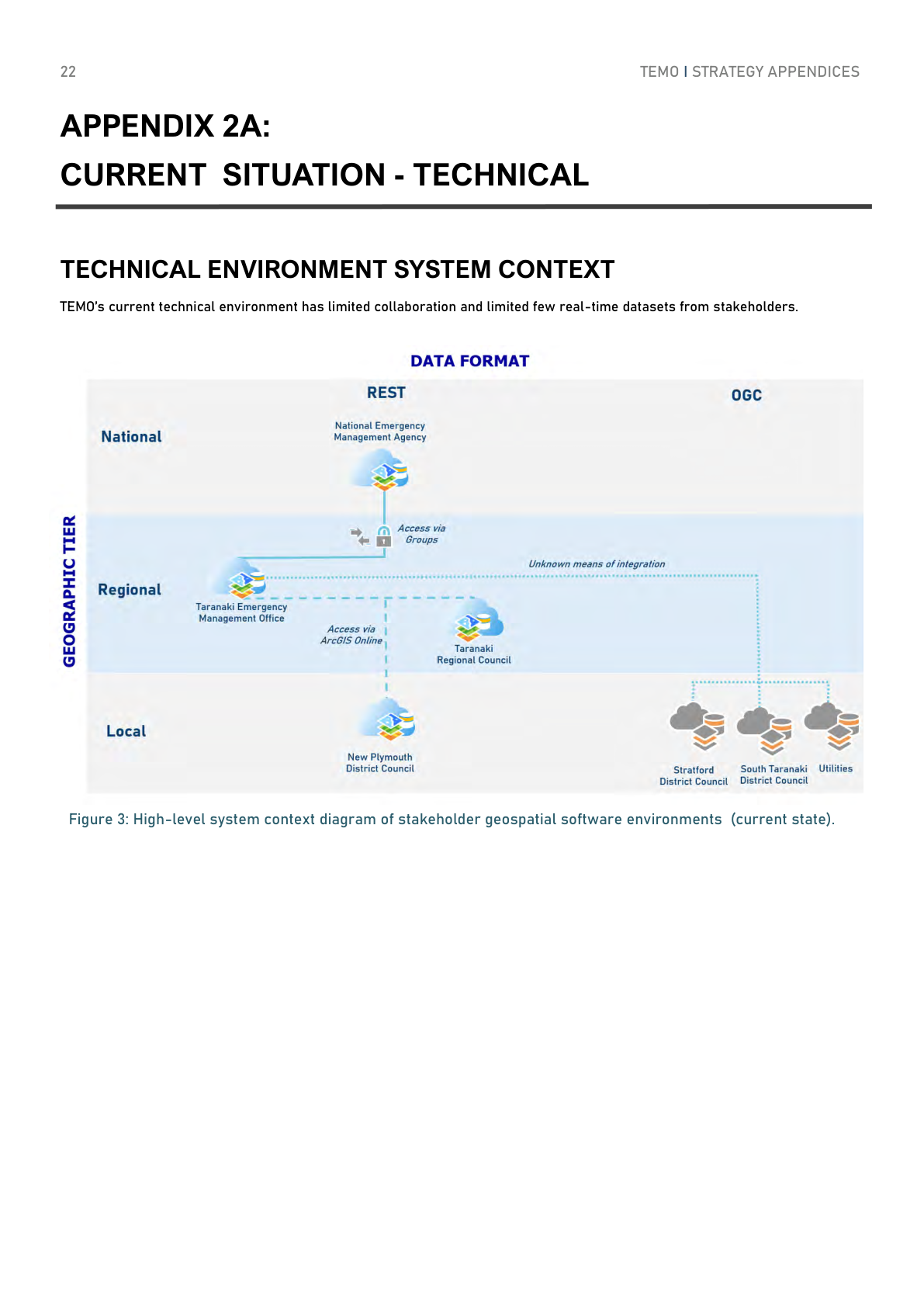
Taranaki emergency GIS current-state diagram, 2021
About this image
The technical system context recorded in the May 2021 Taranaki CDEM strategy. PDF p. 22. This is the documented current state in that strategy.
Read the illustrated passage in Policing and public safety →
Download the original locally stored image
Attribution
Source and reuse
- Credit
- Taranaki Civil Defence and Emergency Management Group; Teresa Gordon and Ed Cook
- Image date
- May 2021 (publication date)
- Original dimensions
- 1191 × 1684 pixels
- Original SHA-256
55bbdea6d5d0a5b20f285548980370ab83cb766a4fc6defeb317ee311e2b62ae- Display preparation
- Full original PDF page rendered at 144 dpi; web and card derivatives are uncropped. Original publication remains available as an unchanged file.
- Local copy
- The reader displays a local copy so the image remains available if the original page changes.