Image archive Image details
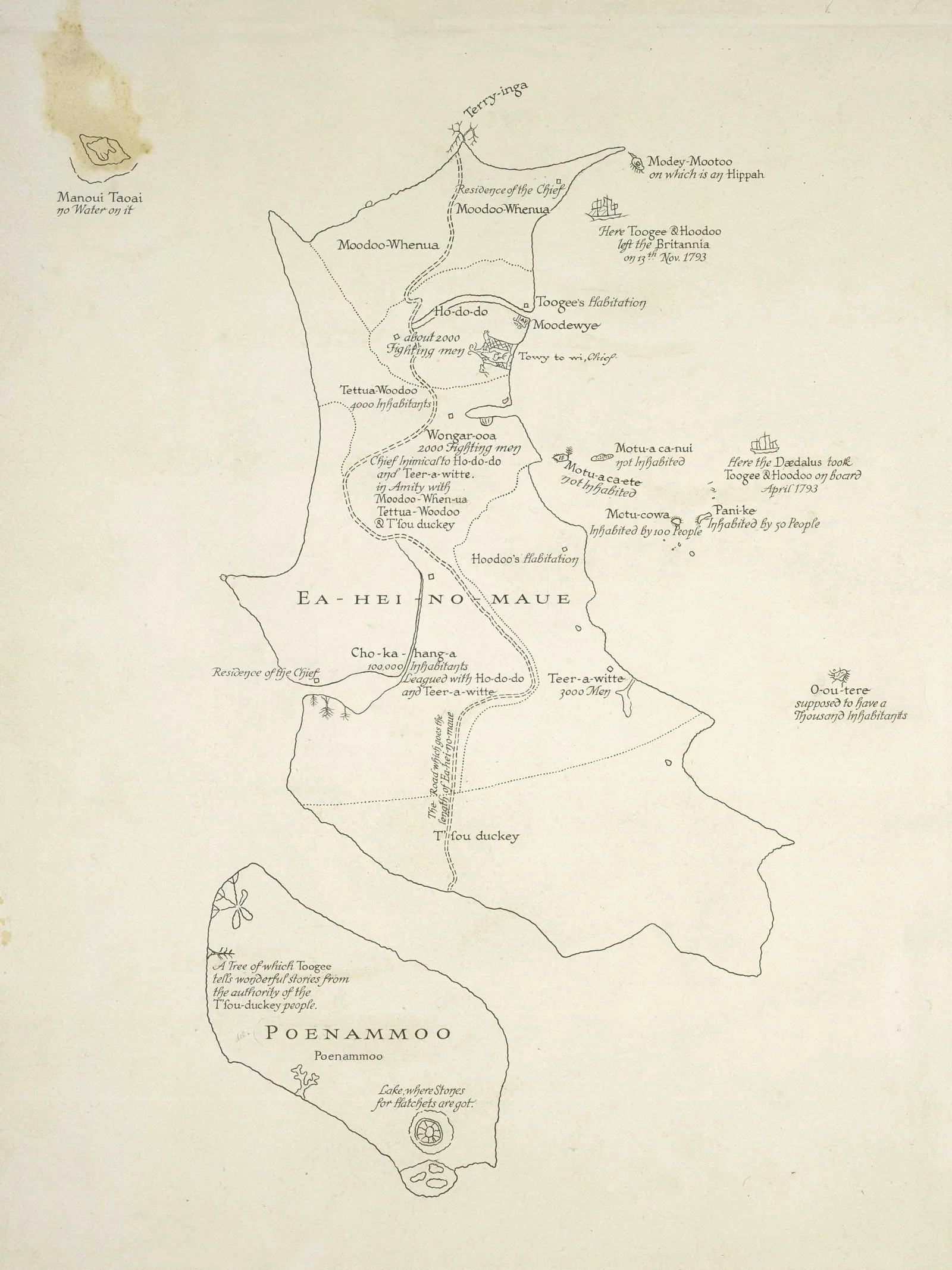
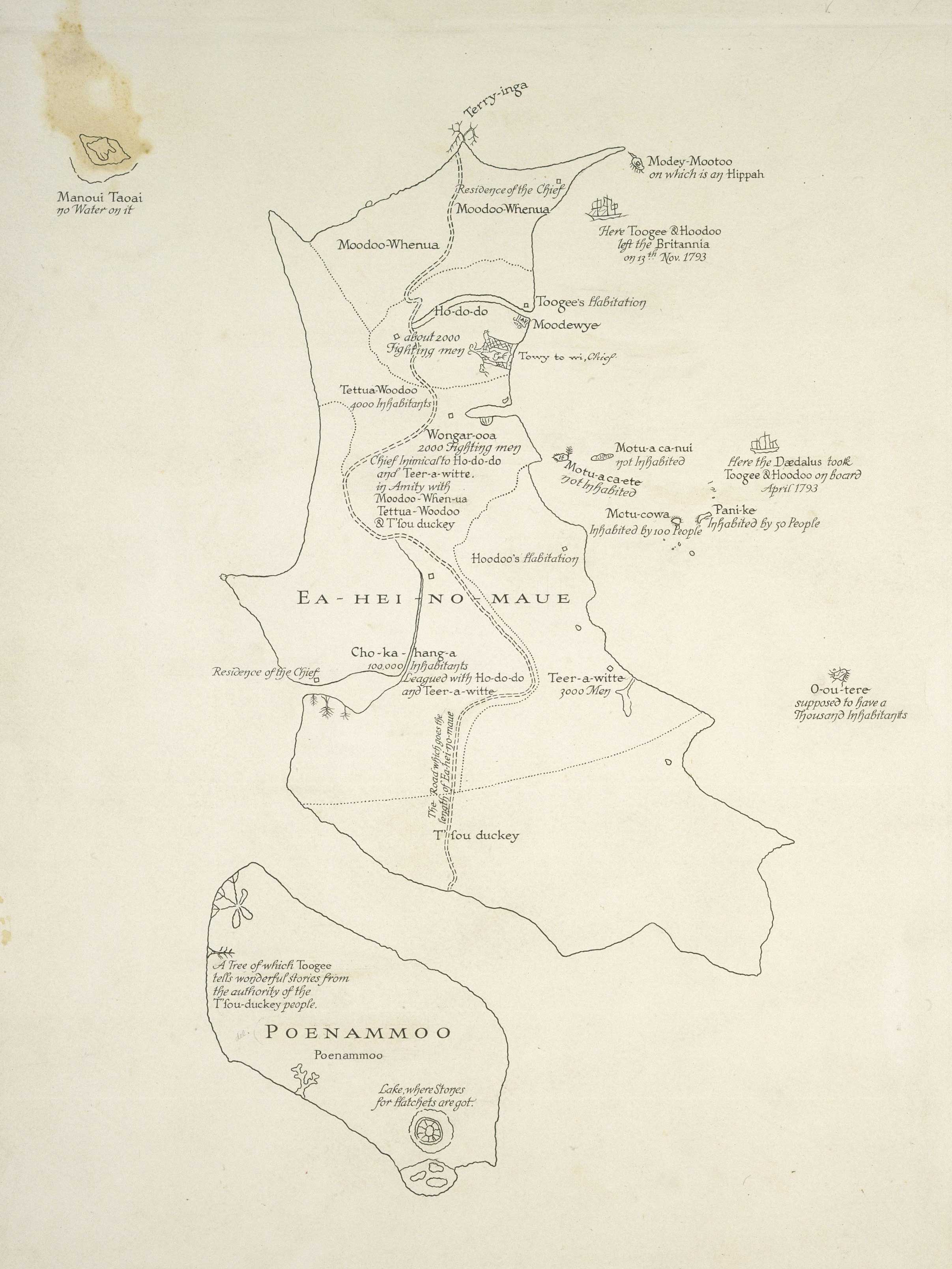
Tuki's map of Aotearoa, drawn in 1793
About this image
This is a surviving copy of a Māori manuscript map. It predates computer mapping and is included to illustrate knowledge represented geographically before modern surveying and GIS.
Download the original locally stored image
Attribution
Source and reuse
- Published on
- Wikimedia Commons
- Credit
- Tuki Te Terenui Whare Pirau; Alexander Turnbull Library, MapColl-CHA-2/1/9-Acc.36440
- Image date
- 1793 (drawing); 1798 (publication)
- Original source filename
- File:New Zealand-Map-by-Tuki-1798.jpg
- Original dimensions
- 2413 × 3217 pixels
- Original SHA-256
7b7804024e498a49d2f516f49a947a0e40f1ee161e210e670ee5477c479bebd7- Licence
- Public domain
- Local copy
- The reader displays a local copy so the image remains available if the original page changes.