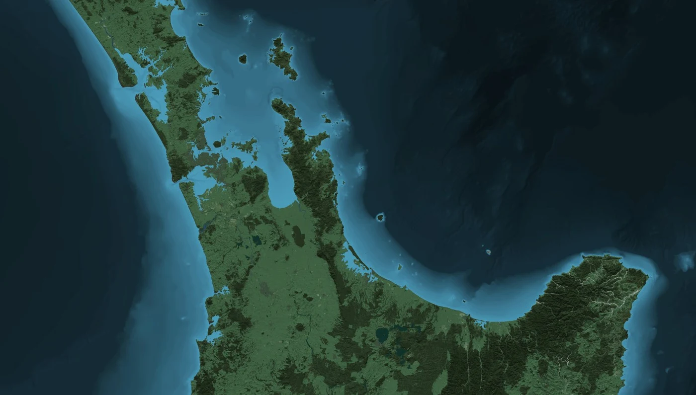
Commercial 4 m national land-cover raster tiles designed by Geographx using Topo50, LCDB3 and relief from its 8 m DEM.
By the September 2012 Taurewa Mountain Cartography Workshop, Geographx had completed a New Zealand-wide set of natural-colour land-cover basemap textures with 4 m pixels. Roger Smith described 116 tiles, each 16,384 pixels square and covering about 65.5 km on a side. The layered Photoshop source files together totalled roughly 420 GB, more than 31 billion pixels.
Sources · 1
- Roger Smith, Designing Raster Base Maps with Photoshop, 8th Mountain Cartography Workshop, 2012, pp 101–106
Unlike a satellite mosaic, the basemap was built from mapped feature data: LINZ Topo50 vectors, land-cover classes substituted from Landcare Research LCDB3, and hillshading from the separately created Geographx 8 m digital elevation model. Smith described Manifold System for GIS preparation, Global Mapper for hillshades and masks, and Adobe Photoshop for scripted layering, tones and textures.
Sources · 1
- Roger Smith, Designing Raster Base Maps with Photoshop, 8th Mountain Cartography Workshop, 2012, pp 101–106
The processing sequence combined physical surfaces, vegetation, built areas, water, transport networks and hillshading. Smith described a script-controlled snowfall effect and exporting registered tiles as GeoTIFF, ECW or PNG for clients. Examples in his 2012 paper show Auckland-area tiles and Skyline TerraExplorer visualisations of the Waitaki and Clarence river landscapes.
Sources · 1
- Roger Smith, Designing Raster Base Maps with Photoshop, 8th Mountain Cartography Workshop, 2012, pp 101–106
The 2015 ICA national report states the 4 m basemap was offered commercially. Its rights differ from the open-licensed 8 m elevation model and from the separate 2013 LINZ TileMill basemap source release. The original 2012 paper has authoritative photographs of Geographx's own screens, but a separate right to republish the paper figures has not been established. A suggested TV3 weather customer remains unverified.
Sources · 4
- New Zealand Cartographic Society, Cartographic Activities in New Zealand 2011–2015, ICA national report, p 14
- Roger Smith, Designing Raster Base Maps with Photoshop, 8th Mountain Cartography Workshop, 2012, pp 101–106
- LINZ, linz_basemaps 2013 reconstruction source, data inputs, TileMill workflow and CC BY 3.0 NZ terms
- MetService, Annual Report 2019, p 19, New Zealand broadcaster use of Weatherscape
Related source links · 3
- 2012 original cartographic paper, with actual Geographx 4m basemap figures
- LINZ's different open basemap source
- Related chapter
Sources and further reading · 4
- Roger Smith, Designing Raster Base Maps with Photoshop, 8th Mountain Cartography Workshop, 2012, pp 101–106
- New Zealand Cartographic Society, Cartographic Activities in New Zealand 2011–2015, ICA national report, p 14
- LINZ, linz_basemaps 2013 reconstruction source, data inputs, TileMill workflow and CC BY 3.0 NZ terms
- MetService, Annual Report 2019, p 19, New Zealand broadcaster use of Weatherscape
Indexed passages
- Company staffCompanies and user groups
- Terrain becomes dataMapping in 3D