NEW ZEALANDGIS History
Menu

Land and environmental datasets

LUCAS New Zealand Land Use Map

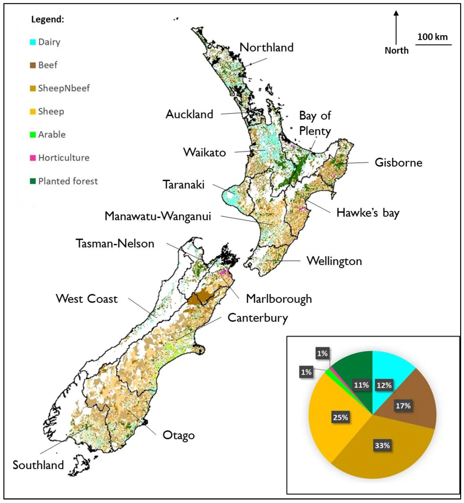
Map of agricultural land use across New Zealand based in part on national land-use and land-use-capability data.
New Zealand agricultural land use mapped with LUC, LUCAS and AgriBase data, 20222022 analysis incorporating LUCAS, LUC and AgriBase inputs.Image source, credit and licence →
Dataset

Nationwide time-series land-use classification for carbon accounting, separate from NZLRI land-use capability.

The Ministry for the Environment's Land Use and Carbon Analysis System (LUCAS) maps land-use classes used to monitor land-use change and report land-sector emissions and removals. The five representative dates are 1989, 2007, 2012, 2016 and 2020.

Sources · 1
  1. Ministry for the Environment, New Zealand land use map

LUCAS is a land-use dataset, not the New Zealand Land Resource Inventory or its Land Use Capability classification. Its categories are based on remotely sensed land cover and supporting interpretation, with a particular emphasis on forests.

Sources · 1
  1. Ministry for the Environment, New Zealand land use map
Related source links · 2
  1. Related history
  2. Ministry for the Environment, New Zealand land use map
Sources and further reading · 1
  1. Ministry for the Environment, New Zealand land use map